Our second trip to the Rwenzori Mountains (June 2016) was through the central circuit. It was amazing talking with the park rangers and guides about our research and how glacier flowed all the way down to Lake Mahoma 20,000 years ago! The rangers are doing fantastic work to monitor the glaciers and the weather in this incredible mountain range.
The moraine ridge is topped by a darker type of vegetation, can you trace the LGM moraine sloping down slightly from left to right?

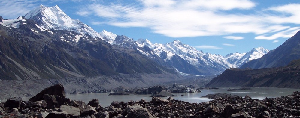
MORE MORAINES! The ridges topped by darker vegetation are moraines, so during the last ice age, glaciers in Uganda, just north of the Equator, flowed as low as 2000 m asl (~6500 ft elevation). Today, you will not see glaciers below 4800 m asl (~15,700 ft elevation).

Bigo Bog Boardwalk

View from Bujuku Hut

Mt Speke + glacier from Lake Bujuku. This whole valley was filled with THICK ice during the last ice age!

Glacier on Mt Speke

Lobelia next to Lake Bujuku

Lobelia

Lake Bujuku from Elephant Pass

Kitandara Lake, just a few steps from the hut

Mt Speke with fresh snowfall in the morning, view from the assent to Freshfield Pass.

Beautiful Rwenzori Afro-alpine vegetation

Bamboo forest

Lake Mahoma

Amazing trip, thanks to support from the Comer Science and Education Foundation!

RPG Photography by A.M. Doughty is licensed under a Creative Commons Attribution-NonCommercial 4.0 International License.
